
July 19, 2006 ☼ Foreign Affairs ☼ Security
The Google Earth community has unearthed (pun unintended) another gem. At a military base near Huangyangtan, China has created a gigantic scale model of the terrain of a part of Aksai Chin, on the disputed frontier with India. (linkthanks Pratik Singh)
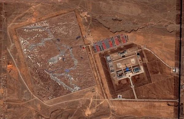
The question is, why? One theory, among the many, put forward is that the model serves as training ground for helicopter pilots: but size of the model (0.6 sq.km) may be too small for this purpose. But it may be what engineers need to work out how to construct roads in that remote region.
© Copyright 2003-2024. Nitin Pai. All Rights Reserved.